Down the coast to Esperance, north to Kalgoorlie & Wiluna, east Uluru to Alice Springs
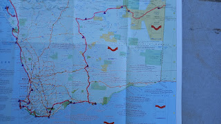

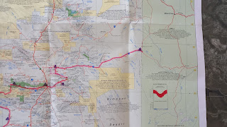
After spending 3 weeks in Geraldton we headed along the coast, past Perth, to Esperance. Then 900km north to Wiluna and 2100km east to Alice Springs via Uluru and the West MacDonnell Ranges.
Down the west coast (sort of) and then east to Esperance
We skipped Perth (except Cottesloe Beach for lunch in the cold drizzle - we stayed in Cottesloe for a few months 25 years ago).
As we headed around to Esperance we spent some time on the amazing (and varied) coast and some in the bush with massive Kauri and Jarrah trees.
The Pinnacles - We were here in 1996 and were a bit surprised to find that WA National Parks have since spent a bazillion dollars building a massive carpark, visitor centre, cafe and concrete paths over the dune. Once away from all the concrete, however, the amazing pointy bits of rock are still pretty cool. 31/10

Busselton has a wooden jetty that, at 1841m, is the longest wooden jetty in a southern hemisphere town called Busselton (or something like that). Pretty impressive (and windy) - it has a tourist train running along it so we went out the lazy way and walked back in.
Cape Naturaliste, near Busselton:


Canal Rocks, Yallingup:

Salmon Beach, Windy Harbour:

Salmon Beach, Windy Harbour:

The Windows, Point d’Entrecasteaux, Windy Harbour:

Greens Pool, Denmark:


Cape Le Grande National Park:


Helen balanced some rocks (in Porongorup NP)

Camping in the sand dunes in Cape Le Grande NP:


After Kalgoorlie we turned off the main road and headed due north to Wiluna. The roads are pretty straight!

We turned right at Wiluna to Carnegie Station (350km) and then onto the western half of the Gunbarrel Highway to Warburton (500km ish).
Blackwood State forest near Augusta:
Beedelup Falls near Pemberton:
An old fire-spotting tree at Gloucester. We decided not to climb!
Albany has an amazing whaling museum. This was the last whaling station in Australia - whales were caught off-shore (obviously!) and towed into the harbour where all the processing was done. It only shut down in 1978 and when they closed the facilities were preserved as a museum. Spent a fair while chatting to a bloke who worked on one of the boats - he was the fireman, responsible for running the oil-fuelled steam boiler (by hand - nothing was automated in the 1950s era engine room.)
More coastline... Natural Bridge, Albany:
In Fitzgerald River NP: The previous evening we chatted to a couple camping near us and by 5:30am Helen had someone to join her on a 23km run along the coastal track. The run finished at this stunning beach at Quoin Head:
The southern coast is not known for its warm weather!
I found an upside-down banksia.
North to Kalgoorlie & Wiluna, then east to Uluru
After Esperance we headed north to Kalgoorlie, site of the Super Pit - until 2016 it was Australia's largest open-cut gold mine. It's pretty big!
Old meets new at some stockyards - the windmill still spins and the base of the old metal tank is there, but the water is now pumped with solar power into a plastic tank.
The Gunbarrel was surveyed, built and named in the 1950s by Len Beadell who tried to make it as straight as possible and called all his outback roads 'highways'. He travelled in a old Land Rover and, due to a lack of OHS rules (and common sense), surveyed large sections by himself. (After nearly dying on one trip he then was obliged to take a second vehicle with him.)
At Carnegie I took Adam for a drive. The juvenile emu is a pet that acts more like a dog than a wild bird - sleeps on the door mat, comes to say hello, etc.


Camping is kind of easy - anywhere will do but finding a patch of sand without much spinifex is a bonus.

Not much of a highway!

Loads of spinifex. It looks fluffy but is the spikiest plant in Australia!

Due to the recent rain there were heaps of flowering plants.

We helped some of the Docker River mob patch a tube.


Adam meeting Reggie Uluru - senior traditional owner of the Big Rock. (If you want to to know more about him and his family, I highly recommend the book "I am Uluru".)


Redbank Gorge:

Ochre pits:

Heading east. We were the first people along the road for about 2 weeks and didn't see anyone for 3 days. Quite remote!
Just after a pre-sunset storm. We had more rain in the central desert regions than at any other times in the last 6 months! There were massive rain storms (100mm+) a couple of weeks before we travelled across the centre and so everything was very green.
One of the vehicles that didn't make it. This one was left on top of a sand-dune.
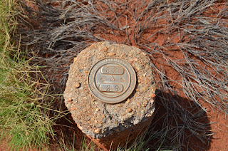
One of the old boundary markers. I'm not sure what boundary it was marking, nor why the Northern Territory was surveying roads in Western Australia.
Back into the Northern Territory
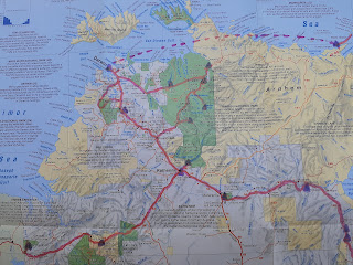
The Gunbarrel finishes at Warburton and it was then 550km along the Great Central Highway to Uluru.
Kata Tjuta in the distance. The photo is taken from the top of a sand dune - we were camped at the bottom.
And up close.
A VERY BIG rock! It was interesting being here as it's almost deserted with no overseas travellers and it being the hotter part of the year.
Mount Connor - just east of Uluru.
King’s Canyon:
West MacDonnell Ranges. Mount Sonder:
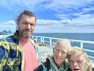
And then to Alice Springs.

Thanks for sharing Phil. Wonderful photos and just the right amount of commentary. Ou r son George is hoping to set out around our island in April next year. I will send him a link to your blog if that’s ok. Happy travels. Which Christmas do you expect to be home by? Regards Stephen Rawlinson
ReplyDeleteHi Stephen! Great to hear George will be exploring too and hope he finds the blog inspiring. See you v soon!
Delete...that "unknown " is Helen :)
DeleteReally enjoy reading about your travels and seeing the wonderful phots.
ReplyDeleteLooking forward to getting into that Great Central country of WA. Thanks for the pics, but also want to see more one day.
ReplyDeleteFabulous country and a great update! Glad you got through to the Centre OK, given all the rain that has been about!
ReplyDelete